Blue trail
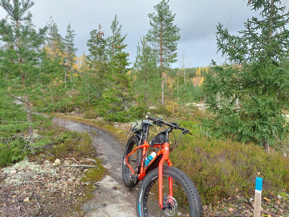
The blue trail starts at Notkopuisto Park and winds through the forests of Temmo and Perttu. The trail passes through many different types of forest and terrain. There are three sections of duckboards along the trail, totalling approximately 130 metres. There are a few challenging sections for mountain biking. The route is groomed in winter by volunteers.
Parking spaces: Notkopuisto, Sivutie and Ridasjärventie 137 (Virtatuvan tie)
Route: Notkopuisto Park – Alho Pond – Water Tower/Nukarin Road – Temmo Forest – Pertun Swap Ponds – Mast/Nukarin Road – Fitness Trail – Notkopuisto Park
Length: 5.8 kilometres
Marking: Blue circular markings on trees, posts on the ground with blue tops and reflective tape, blue arrows
Difficulty: Moderate (some rocky terrain, no significant elevation changes)
Description: The blue route starts from Notkopuisto and goes around Alho pond. For a short distance, continue along the fitness track that starts at the fitness equipment to the old ski slope. From the old ski slope, climb up to Temmonmäki, towards the water tower. From the water tower, the route continues over Nukarintie towards Perttu. The route turns left to the roadside trees and goes for two loops in Temmo. From the roadside trees, walk for about 100 meters and turn left towards Nukarintie. Just before Nukarintie, turn right and after about 100 meters, turn right again, from where you climb up the rocks. From the rocks, descend back to the intersection where the loop started. From here, continue left to another of Temmo’s loops. This loop initially runs towards Temmonkaari and turns towards Perttu (Kellonsoittajantie). The route comes to a light traffic route, along which you go right for 80 meters. After this, the route turns right into the forest and returns to the picket fences.
After the picket fences, continue straight to the Perttu swamp ponds. After the swap ponds, the route turns right, and you will come across the longest picket fences on the route (58 meters). After the picket fences, the route turns right towards Nukarintie. After crossing the road, the route continues towards the fitness track. From the intersection with the fitness track, a lean-to can be seen on the right, approximately 80 meters away, next to the fitness track. After crossing the fitness track, the cross-country trail continues to the intersection of the paths, from where you can go straight to the yellow trail, and the blue trail continues to the right. The route comes back to the fitness track, from where you turn left after 30 meters to the old ski slope, along which you return towards Notkopuisto.
Identified hazards:
- There are two crossings on Nukarintie, one at the water tower and the other at the mast.
- Rocky and stony areas and tree roots are slippery when wet.
- The duckboards may be slippery when wet or icy.
Enable location services on your phone and select “show location” on the map. You will then be able to follow the route.
Etiquette for those travelling on trails and in nature
- Dogs must be kept on a leash on forest trails. Without the permission of the landowner or hunting rights holder, dogs may not be allowed to run free on another person’s property.
- Familiarise yourself with everyone’s rights and forest/wildfire wa
ings before lighting a fire.
Know your rights and responsibilities. - Be mindful of nature and other people out and about.
- On footbridges and paths, give way to oncoming traffic. It is
often easier for a pedestrian to step aside than a cyclist. - Take your rubbish with you. Do not leave it in the countryside.
- Leave the animals in the forest in peace. For example, do not try to photograph animals from too close up.
This content has been translated using AI