Planning hierarchy
Land use planning proceeds hierarchically, with more general plans guiding more detailed plans and their content. Planning is regulated by the Land Use Act and the regulations issued under it.
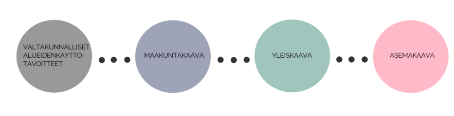
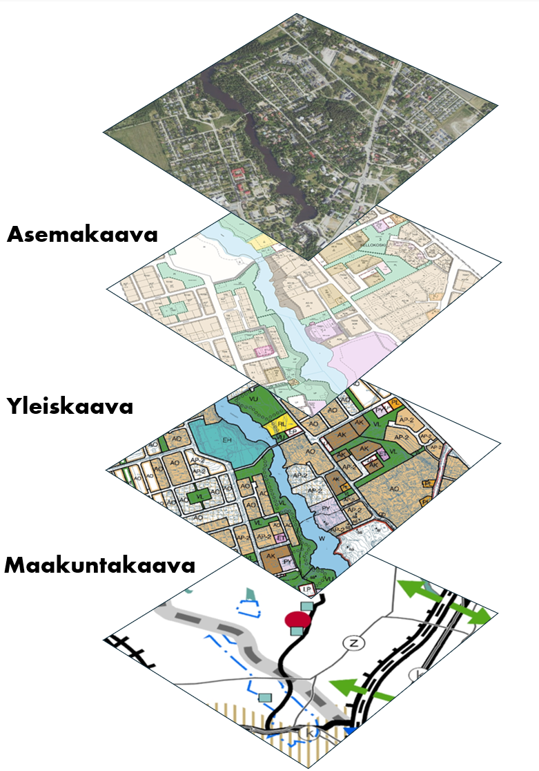
Land use planning is based on a system of plans that becomes more detailed as it progresses from general to specific. This is known as a hierarchical planning system. The principle of the system is that a broader and more general plan or other plan guides more detailed planning. In addition, the planning hierarchy means that when a more detailed plan has been completed and approved, it replaces the higher-level plan.
The most general level consists of national land use objectives (valtakunnalliset alueidenkäyttötavoitteet) and regional land use plans (maakuntakaava). National land use objectives outline the use of areas in matters of national significance and are decided by the Government. A regional plan is a general plan for land use in a region or part of a region. It sets out the principles for land use and community structure and identifies areas that are necessary for the development of the region.
The regional plan is specified in more detail in the master plan (yleiskaava). The purpose of the master plan is to provide general guidance on the community structure and land use of a municipality or part thereof and to coordinate activities.
Local detailed plans (asemakaava) are the most detailed, precise and binding types of plans.
The name of the Land Use and Building Act (maankäyttö- ja rakennuslaki), which regulates zoning, has been changed to the Land Use Act (alueidenkäyttölaiki).
This content has been translated using AI